 |
Conservation Hub Sites
National Forest Integrity Project
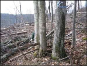
Hub sites have been developed for eight proposed or recently approved projects involving commercial timber harvest and road development in the National Forests of the Allegheny-Blue Ridge region. Multiple ABRA partners are engaged in the review process for these projects.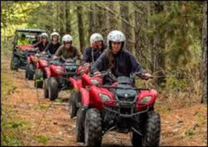
ORV Use on Public Lands
This Hub site addresses the environmental damage, disruption, and ongoing costs that come with off-road vehicle use and the continuing push to allow more off-road vehicle use in state and federal public lands in West Virginia.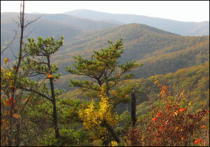
Proposed Shenandoah Mountain National Scenic Area
Located west of the Shenandoah Valley in the George Washington National Forest, Shenandoah Mountain is one of the largest tracts of wild land in the Eastern United States. A broad coalition seeks to permanently protect this special area for the benefit of future generations.
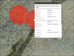
Candy Darter Preservation and Restoration
This Hub site relates the remnant distribution of this endangered species to environmental context and proposed land management projects, providing a framework for oversight of agency responses to requirements of the Endangered Species Act.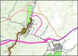
Corridor H Planning and Construction
The incomplete four-lane highway known as Corridor H in West Virginia covers some of the most mountainous terrain in the eastern United States. This Hub Site will provide mapping for construction plans, sensitive ecosystems, known violations, and other sites of significance along the route.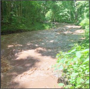
Coal Mining Infrastructure Affecting Aquatic Habitat
A new Hub site will examine regulatory oversight of mining operations and haul roads affecting brook trout streams and critical habitat for the endangered candy darter in the South Fork of Cherry River area.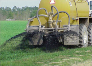
Land Application of Biosolids
Land application of wastewater treatment plant sludge and other biosolids is not well-regulated and concern about PFAS and other problematic chemicals is increasing. A Hub site will initially provide mapping for existing and proposed application locations in two Shenandoah Valley counties.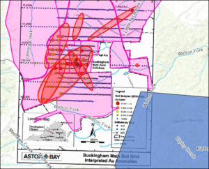
Gold Prospecting
Following the 2020 announcement of “promising” gold deposits in Buckingham County, Va., opposition to mining has developed due to concerns about loss of agricultural land, toxic mine waste dumps, and pollution of local ground water and the nearby James River.Online Here
Ridgeline Wind Energy Development
Since 2016, Apex Clean Energy has been pursuing Virginia’s first on-shore, ridge-top, utility-scale wind energy facility. Planned for North Mountain in Botetourt County, Va., the Rocky Forge project would include up to 22 turbines, each 680-ft tall.Online Here