 |
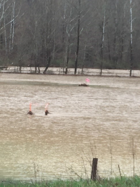 |
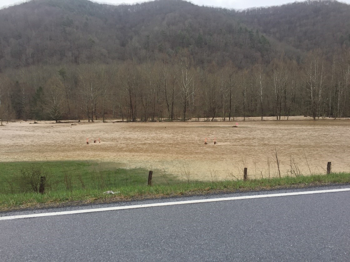
The photos above were taken on Monday, April 16, in the Valley Center area of Highland County, VA, following a night of heavy rainfall. The location is where the Atlantic Coast Pipeline (ACP) would cross Back Creek Valley. Seen on the left is how Back Creek has swelled from a few yards wide in its normal flow. The flag markers for the ACP are prominently shown in the photo the right. This type of scene was no doubt replicated in dozens, if not hundreds, of other locations along the mountainous areas of the ACP route in Virginia and West Virginia. And, one can be assured that this scene will take place several times a year. Were it to occur during construction, the resulting erosion would be of disastrous proportions. Were it to occur, after the ACP trench is filled and sealed, the scar to the land left by the construction would be susceptible to landslides on the steep slopes that characterize so much of the project route. ABRA has warned of this problem since the pipeline was first proposed, and Mother Nature has verified it.